Christian O'Brien's Lecture Map - 1984
Christian O'Brien's Lecture Map - 1984 of the Near East Locating Kharsag - Head Enclosure or Garden of Eden - Marked in Red - North of Mt Hermon
|
|
Christian O'Brien's Lecture Map - 1984
Environs of the Rachaiya Basin
Mount Hermon (Arabic: Jabal el-Shaiykh, Djabl a-Shekh, mountain of the chief and snowy mountain)
The Havens (below) are those recorded in the Chronicles of Enoch, which describe in detail Enoch's journey to meet the Great Lord - Chapter 4 - Genius of the Few - Map from p. 314
|
|
Kharsag - Environs of the Rachaiya Basin - O'Brien Map.
Outline Contour Map of the Rachaiya Basin with Speculative Placements of Structures mentioned in the Kharsag Epics. The Great Watercourse is shown running East - West from the Dam Wall Overflow to the Outlet into Wadi en Neirab
|
|
Speculative Placements of Structures mentioned in the Kharsag Epics.
|
|
O'Brien's Hand Drawn Map - 1984 - Speculative Placements of Structures.
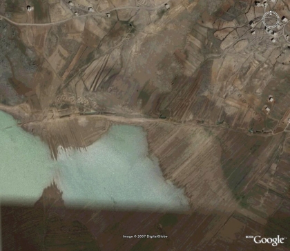
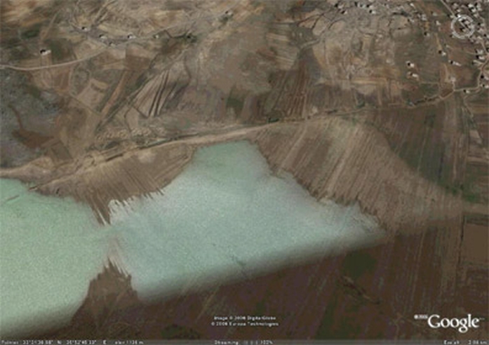
Google Image showing the watercourse.
Google image of the Great Watercourse - North Bank of the Basin
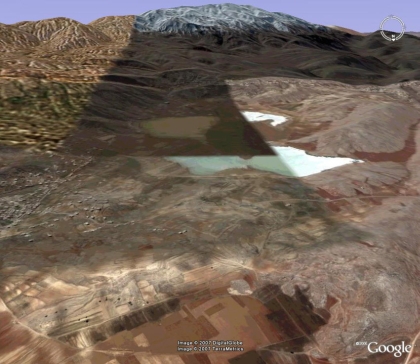
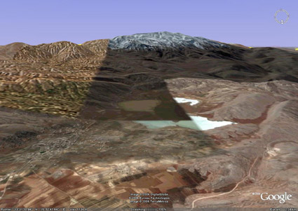
Looking South Back to Mt Hermon over the Basin
Looking south to Mt Hermon, over the Rachaiya North and South Basin’s, with the village of Kfar Qouq on high ground to the left foreground, and the town of Rachaiya in the right background. The shading is the result of the satellite images taken at different times of the year. This shows different levels of flooding in the south basin
Christian O’Brien in the Genius of the Few provides the evidence that a dam was constructed and reservoir formed in the narrow valley east of Kfar Qouq, and that an overflow watercourse was built along the north bank of the south basin to take surplus water into the Wadi en Neirab, middle right.
This would have provided irrigation in what would in consequence have been a large, dry, fertile and level area for livestock, crops and orchards; possibly an ancient lake bed. The Sumerian cuneiform records that the dam and watercourse were destroyed by a 1,000 year storm. This event is dated to c. 6,500 BC from linked evidence.
Rachaya Basin South - Kharsag or Eden
Rachaya Basin South - Kharsag or Eden - Now silted up and seasonally flooded. For full description and maps read the Genius of the Few.
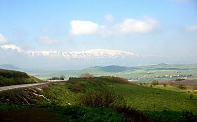
Mount Hermon from the Bekaa Valley


