Proposed Site for Kharsag / Eden
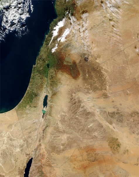
Kharsag/Eden is located 8 miles north of Mt Hermon at the south eastern end of the Beqaa Rift Valley, which lies between the snow capped mountains of the Lebanon and Anti-Lebanon mountain ranges (at the top of this satellite image of the Near East) - O'Brien distinguishes the planted Highlands (ha'shemim), from the Lowlands (arez) within the sheltered and relatively warmer Rift Valley, running beyond Jericho and the Dead Sea to the Gulf of Akaba and the Red Sea.

Mount Hermon (Jabal el-Shaiykh, Djabl a-Shekh, mountain of the chief and snowy mountain)
The Havens (below right) are those recorded in the Chronicles of Enoch, which describe in detail Enoch's journey to meet the Great Lord - Chapter 4 - Genius of the Few
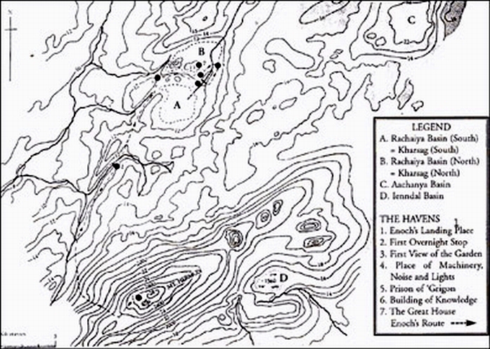
Map to illustrate the Environs of the Rachaiya Basin and Mount Hermon - p314 Genius of the Few
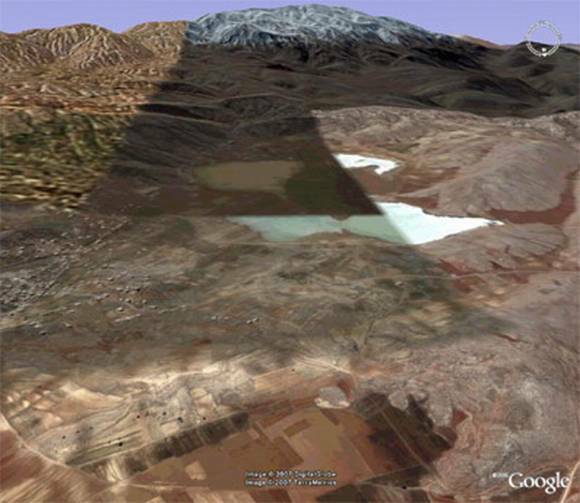
Looking south to Mt Hermon, over the Rachaiya North and South Basins, with the village of Kfar Qouq on high ground to the left foreground, and the town of Rachaiya in the right background. The shading is the result of the satellite images taken at different times of the year. This shows different levels of flooding in the south basin
Christian O'Brien in the Genius of the Few provides the evidence that a dam was constructed and reservoir formed in the narrow valley east of Kfar Qouq, and that an overflow watercourse was built along the north bank of the south basin to take surplus water into the Wadi en Neirab, middle right.
This would have provided irrigation in what would in consequence have been a large, dry, fertile and level area for livestock, crops and orchards in a former lake-bed. The Sumerian cuneiform records that the dam and watercourse were destroyed by a 1,000 year storm. This event is dated to c. 6,200 BC from linked evidence.
Outline Contour Map of the Rachaiya Basin with Speculative Placements of Structures mentioned in the Kharsag Epics
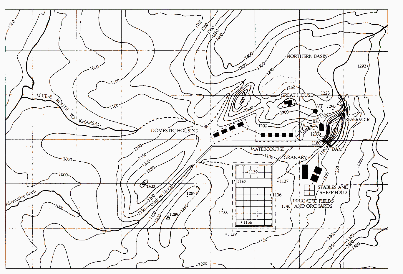
French Survey Map with Speculative Placements of Structures mentioned in the Kharsag Epics.
Features not to scale (p. 315 Genius of the Few) - The Great Watercourse is shown running East-West from the Dam Wall Overflow to the Outlet into Wadi en Neirab - Google Map showing the watercourse below.
Google Map watercourse highlighted in blue.


